

Street Names Of Wigston And Their Meanings
The streets of Wigston project was started in early 2017 jointly by the Wigston Civic Society and the Greater Wigston Historical Society with the objective of recording the names of the Wigston Streets and the origin of their names.
Helen Hay undertook the work and pulled together the information from multiple sources some of which are recorded below.
New estates and roads are being added year by year and will be uploaded to the web periodically.
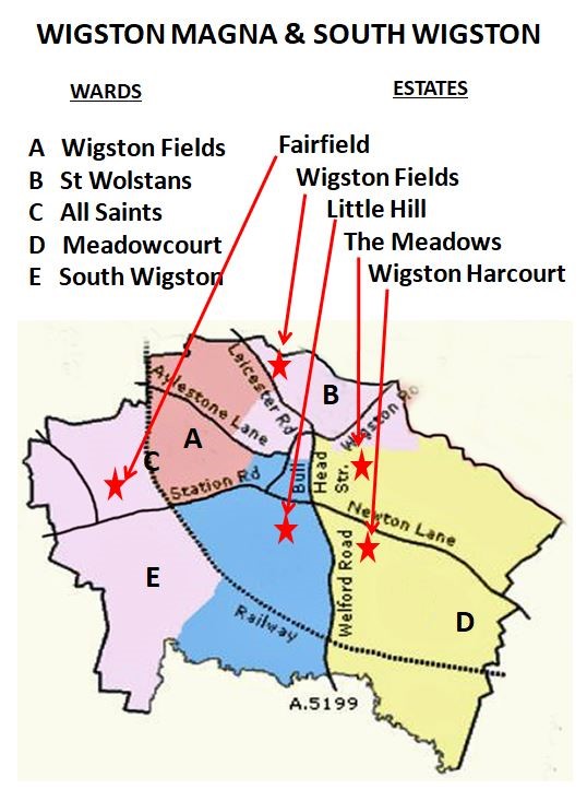
To identify the areas where the roads are located we have created a basic map showing the Political WARDS of the area and then indicated where the major estates are located.

To find a specific road you can look at the lists sorted by WARD or AREA from the boxes below.
Click on the name of a file to view it..
|
WARD
|
AREA
|
|
|
|
|
|
Sources:-
P. Cousins: Orson Wright
M. Forryan: original list of street name meanings
W G Hoskins: The Midland Peasant
W G Hoskins: The Streets of Wigston in the 1930's updated by Duncan Lucas
D Lucas: Wigston Harcourt (not the full title)
Blue Plaque Guide
THE FILES ARE IN ADOBE .PDF FORMAT, FOR WHICH YOU WILL NEED ADOBE READER SOFTWARE
A FREE COPY OF ADOBE READERCCAN BE DOWNLOADED AT:
THE GREATER WIGSTON
HISTORICAL SOCIETY


